| MORUYA - NEW SOUTH WALES - 2600 | ||||
|---|---|---|---|---|
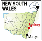 |
Population: 2,600, Height above sea level: 10m Latitude: 35.53.00, Longitude: 150.07.00 Location: 300km south of Sydney Highway: Princes hwy (1) Nearest Major Town: Sydney 300 N Nearest Airport: Moruya Touring Area: South Coast |
 |
 | |
 | ||||
|
Small but busy south coast town on the Moruya River and the head office of the Eurobodalla Shire.
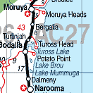
Nearby Deua National Park and beaches make it a popular holiday destination. Granite from quarries here was used to build the pylons of the Sydney Harbour Bridge. The Eurobodalla Historic Museum recalls the development of the area. Gold was discovered at Mogo, some 20km. north in 1857s, and a mini-goldrush ensued with several hundred diggers scrambling to the goldfield. The reconstructed village of Mogo represents these diggings in detail. Surrounded by National Parks and with sandy beaches, Moruya is an ideal getaway destination only a few hours drive from Sydney or Canberra, and a perfect stopover if travelling between Melbourne and Sydney Just east of Moruya a visit to Moruya Heads and Congo is a pleasant drive. PLACES OF INTEREST: ACCOMMODATION & SERVICES: 
|


© Copyright Peter W. Wilkins