 |
Agnes Water QLD 4677 |
|---|---|
| Population: 1,800 Height above sea level: Sea level Latitude: 24.1245, Longitude: 151.5410 Location: 530km north of Brisbane and 70km north of Bundaberg Highway: Off Bruce Hwy, turn off at Miriam Vale for 60km. Nearest Major Town: Gladstone Nearest Airport: Gladstone Touring Area: Gladstone Region | |
| Seaside town and surrounded by national parks.
The most northerly surf beach in Queensland. watersports, bushwalking. It is believed to be named after the schooner Agnes which was lost off the coast there in 1873. It was a timber and sawmilling area and weekend shacks were built as its pupolarity as a beach increased. | |
 |
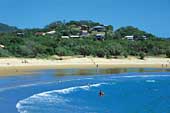 Agnes Water - Courtesy of Tourism Queensland |
| To see a map of the town, click on the top map, for a map of the area, click on the bottom map, for more information about the town, click on the photograph. | |
 |
© Copyright Peter W. Wilkins | |