 |
Dysart QLD 4745 |
|---|---|
| Population: 270, Height above sea level: , Latitude: 22.3500, Longitude: 148.2100 Location: Nearest Major Town: Mackay Nearest Airport: Mackay Touring Area: Mackay Region | |
|
Nature lovers will enjoy the surrounds of the Lords Table Mountain, located approximately
35 kilometres west of Dysart along the Dysart-Clermont Road. Introduce yourself to the
brilliant hues and unusual shapes of this majestic mountain, while marvelling at the peak's
sheer size and scope! It is just one of many volcanic plugs in the Peak Downs National Park
that are the remains of volcanic activity from millennia past. Lords Table Mountain is a very distinguished peak, easily identifiable from considerable distances by its almost totally flat summit! It can easily be seen from Capella, along the Peak Downs Highway and even, Dysart. The flat top is actually divided in two, with the smaller plateau, Anvil Peak, marked at 737 metres, or 2,919 feet, presumably being the highest point, as the rest of the plateau is not given a summit height. If you are fully self-sufficient, it is a beautiful spot to set up and spend the night. For a fabulously fun family day, why not do some bushwalking and discover more of Mackay's prosperous hinterland. Donšt forget to pack the camera and plenty of fresh drinking water! | |
 |
 Lord's Table Mountain west of Dysart. |
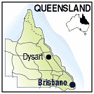
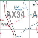
| To see a map of the town, click on the top map, for a map of the area, click on the bottom map, for more information about the town, click on the photograph. | |
 |
© Copyright Peter W. Wilkins | |