 |
Eungella QLD 4757 |
|---|---|
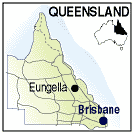
| Population: 50, Height above sea level: , Latitude: 21.08.00, Longitude: 148.30.00 Location: 1,050 north of Brisbane Highway: Bruce Hwy (1) Nearest Major Town: Mackay Nearest Airport: Mackay Touring Area: Mackay and District | |
| Small town in the Eungella National
Park west of Mackay. Located in the Great Dividing Range west of Mackay this attractive town is surrounded by rainforest with mountain and forest walks. See above park link. | |
 |
 |
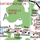
| To see a map of the town, click on the top map, for a map of the area, click on the bottom map, for more information about the town, click on the photograph. | |
 |
© Copyright Peter W. Wilkins | |