 |
Horn Island QLD 4875 |
|---|---|
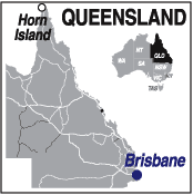
| Population: 650, Latitude: 10.6000 S Longitude: 142.2833 E Location: 3,000km north of Brisbane Highway: Off Peninsula Developmental Road Nearest Major Town: Cairns Nearest Domestic Airport: Cairns Touring Area: Tropical North | |
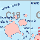
| Island off Cape York and the most northerly air force
base in Australia. Access from Bamaga. 4WD only from Weipa. Roads often impassable
after rains. A barge operates from Cairns. It came to prominence during World War II when it suffered eight Japanese air raids. Today the island has a small population of approximately 650 people, with a focus on pearling and fishing and has the only major airport in the Torres Strait Island group. Visit the museum and art gallery in the small town of Wasaga and some of the historic World War II sites on one of the tours that operate on the island. Wilkins Tourist Maps Pty Ltd produce an A3 tear-off map of Thursday Island, Horn Island and the Torres Strait for the Torres Strait Council. SEE THURSDAY ISLAND | |
 |
 Wharves on Horn Island |
| To see a map of the town, click on the top map, for a map of the area, click on the bottom map, for more information about the town, click on the photograph. | |
 |
© Copyright Peter W. Wilkins | |