 |
Sarina QLD 4737 |
|---|---|
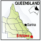
| Population: 3200, Height above sea level: , Latitude: 21.26., Longitude: 149.13. Location: 940km north of Brisbane Highway: Bruce Hwy (1) Nearest Major Town: Mackay Nearest Airport: Mackay Touring Area: Mackay and District | |
|
Small town south of Mackay in sugar country which has the distinction of being the
largest coal exporting facility in the Southern Hemisphere. These can be seen from the
Port Administration Building at Hay Point which provides a lookout over the facility. Located at the base of the Connors Range Sarina has extensive beaches with some 90km fronting the Coral Sea and Barrier Reef. Boat ramps, swimming, surfing and fishing are all popular activities in Sarina and there is a variety of accommodation to suit every need. In town you can visit the new Historic Centre and the Sarina Art & Craft Centre in the old court house, as you explore the towns streets and stop for refreshments at the many cafes and coffee lounges providing excellent food and service. On the highway the 'Field of Dreams' is one of Sarina's newer attractions and features a mini operational sugar mill and distillery. You will learn about molasses distilling and the manufacture of rum and other alcoholic spirits. Information is available from the Sarina Information Centre, Railway Sq. Sarina. QLD or Ph: 07 4956 2251. | |
 |
 |
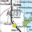
| To see a map of the town, click on the top map, for a map of the area, click on the bottom map, for more information about the town, click on the photograph. | |
 |
© Copyright Peter W. Wilkins | |