 |
Taroom QLD 4420 |
|---|---|
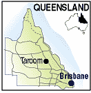
| Population: 650, Latitude: 25.39.00, Longitude: 149.48.00 Location: 485km north west of Brisbane Highway: Leichhardt Hwy Nearest Major Town: Miles Nearest Airport: Taroom Touring Area: Toowoomba & Golden West | |
|
Taroom is on the Dawson River in Queensland. in the Shire of Banana.
Explorer Ludwig Leichhardt passed through the district in 1844, carving his initials
and date on a coolibah tree in the centre of town but it is no
longer visible following an alleged attempt to remove bark growing it that removed
the initials as well. His report of rich soils in the area, encouraged settlers to take up land in 1845
and by 1850 a town was established at a popular camping spot near the Dawson River. Originally named 'Bonners Knob' it was officially renamed Taroom, possibly after the nearby Taroom cattle station, on completion of the first post office in 1856. The name Taroom is said to be an aboriginal word for native fruit trees in the area. Situated 40 km west of Taroom is Hornet Bank Station which was the site of the 1857 Hornet Bank massacre, the reprisals for which led to the extinction of the Yeeman Indigenous language group and people. Taroom is a major centre for the Queensland beef industry. Other industry includes prime hard wheat and forestry. Taroom has a rare windmill of unusual design located on the banks of the Dawson River. The windmill was produced by the Steel Wings Company in North Sydney between 1907 and 1911, one of only six models ever erected. The windmills comprise a steel frame and fan which turns to the wind between a bearing at the bottom and a swivel at the top, all supported by guy-wires. Along with a windmill in Jerilderie in the Riverina, the fully restored windmills are the only two known working examples in the world designed so their fan is contained and spins within the fully pivoting frame. Isla Gorge National Park, Precipice National Park and Expedition National Park are all nearby. | |
 |
 Leichhardt's Tree in the main steet. |
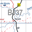
| To see a map of the town, click on the top map, for a map of the area, click on the bottom map, for more information about the town, click on the photograph. | |
 |
© Copyright Peter W. Wilkins | |