 |
Westwood QLD 4702 |
|---|---|
|
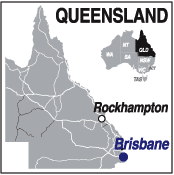
Population: 250 Height above sea level: , Latitude: 23.2655 Longitude: 150.9089 Location: 50km SW of Rockhampton Highway: Capricorn & Leichhardt Hwys Nearest Major Town: Rockhampton Nearest Airport: Rockhampton Touring Area: Rockhampton and District | |
|
Small town on the Capricorn Hwy. The Great Northern Railway (now The Central Line) reached the area from Rockhampton in 1867 and Westwood became the busy railhead shipping wool and produce until 1873 when the line progressed west and the town declined. | |
 |
 |
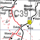
| To see a map of the town, click on the top map, for a map of the area, click on the bottom map, for more information about the town, click on the photograph. | |
 |
© Copyright Peter W. Wilkins | |