 |
Ardrossan SA 5571 |
| Population: 1000, Height above sea level: 5, Latitude: 34.26.00, Longitude: 137.55.00 Location: 150km north west of Adelaide Highway: Off Highway 1 at Port Wakefield Nearest Major Town: Adelaide Nearest Airport: Adelaide Touring Area: Yorke Peninsula | |
|
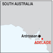
Ardrossan is 150 km. north of Adelaide on the eastern edge of the Yorke
Peninsula and towards the top of the Gulf St. Vincent. It has a population of
around 1,000 and is the major eastern port of the peninsula servicing the mining
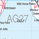
and grain industries. It was named by Governor Fergusson after the town of the same name in Ayreshire, Scotland and was proclaimed in 1873. Until then it was known locally as 'Parara' or 'Clay Gully', a reference to the high clay cliffs on which it sits overlooking the port. These cliffs glow a briliant ochre with reflected light at sunrise and sunset. Ardrossan is a popular holiday destination on the peninsula and has much of interest to see. The 'Stump Jump' plough which revolutionised the clearing of forested land, was invented in South Australia by the Smith Brothers, and was manufactured in Ardrossan for many years.Part of the factory has been converted into a local museum and it, and another museum of local history are operated by the National Trust. The town is also known as the home of the 'Blue Swimmer' crab, a delicacy found in the two gulfs which lie either side of the peninsula. These are easily caught in season from the beach. There are 2 hotel/motels in the town, a caravan park, a holiday village, and self-contained accommodation. See Ardrossan map | |
 |
 Historic buldings in Ardrossan |


© Copyright Peter W. Wilkins