|
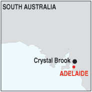
TOWN OF CRYSTAL BROOK
Crystal Brook takes its name from the spring-fed creek next to which it was founded.
It is located on Goyder's Line an east-west imaginary line formed by surveyor
George Goyder, above which he deemed the harsher climate unsuitable for agriculture.
The temperate mediterranean style climate makes possible slightly more intense farming
in the region although to the west and north-west the land is marginal and semi-arid.
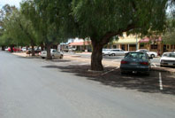
The local farming community supports many small businesses in the town including a supermarket,
bakery and agricultural suppliers.
The Crystal Brook (or creek) which divides the town north-south supplied water until
1890 when the Beetaloo Reservoir was completed, at the time,the largest concrete dam
in the southern hemisphere.
Just north of the brook is a challenging golf course which is well used.
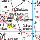
It is a major railway junction where the 'Overland' (Sydney to Perth) and the
'Ghan', (Adelaide to Darwin) railways meet.
Crystal Brook is on the Heysen Trail, a 1,200 kilometres (746 mi) walking
trail from Cape Jervis on the southern Fleurieu Peninsula, to Parachilna Gorge in the
Flinders Ranges.
|