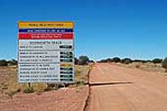
THE OODNADATTA TRACK 619km
(Begins at Marree 647m. north of Adelaide)
The Oodnadatta Track is an alternative route from Adelaide to Alice Springs and mainly follows the route taken by explorer John McDouall Stuart between Marree and Marla on his epic crossing of the continent from south to north in 1862. It passes through William Creek and Oodnadatta and follows what was the route for the Overland Telegraph line which joiuned Australia with Java and Europe. It was also the route for the original 'Ghan' railway line between Adelaide and Alice Springs finished in 1829. It is unsealed for its duration and has sandy patches.
If you are planning to do this adventurous journey you can obtain up to theminute information on conditions from the
Northern Area Road Condition Hotline on 1300 361 033
OUTBACK TRAVEL TIPS
LAKE EYRE NATIONAL PARK:1,228,000 Ha.
National Parks Permit required.
Telephone: (61 8) 8648 5328 for information.
The turn-off to Lake Eyre National park is 3km. west of Marree. there are 2 access points to the park. One via Muloorina Station to Level Post Bay, 90km. north of Marree. The other 7km. east of William Creek, then 53km. east to Halligan Bay on the south-west corner of Lake Eyre North. There are no facilities in the park and you should take all provisions and adequate supplies of fuel and water. A camping area is available at Muloorina Station waterhole on the way to the lake, but there are no facilities at the campsite.
In 1964 the late Sir Donald Campbell set a world land-speed record of 403.1 m.p.h. (645kph) on Lake Eyre in his jet-powered car 'Bluebird'.
The park includes all of Lake Eyre North and the adjoining Tirari desert and is internationally significant. Vegetation within the park is typical of saline soil, samphire, saltbush, and bluebush including Acacia and cassia.
The unique Lake Eyre Dragon is found only on the saltpans of the Lke Eyre Basin and considerable bird life is evident when the klake has water.
Lake Eyre North has a capacity of 8,340 square kilometres and is 144km. long and 77km. wide. It is 15.2 metres below sea level at its lowest point and drains an area of more than 1/16th of the Australian continent. The thickness of the salt-crust of its surface varies, but in some locations it is up to 5 metres thick. Driving on the lake surface is extremely dangerous and is not permitted by the National Park and Wildlife Service.
The desert surrounding the lake in the national park has north-south dunes interspersed with a number of salt lakes. Significant fossil deposits have been found at Lake Ngapakaldi at its far eastern edge.In the early 1970's, and again in the early 1990s when Lake Eyre and South Lake Eyre were filled to capacity after extensive inland rains. At such times waves of several metres can be seen on the surface and the vast area of the lake has an affect on weather patterns of the whole continent.
ELLIOT PRICE CONSERVATION PARK: 64,570 Ha.
Located 105 Ha. north-west of Marree on the southern edge of Lake Eyre North it was the first arid zone reserve, dedicated in 1967. It encompasses Hunt Peninsula, an isthmus of limestone covered in part by wind-blown sand, jutting into Lake Eyre North.
Vegetation is low sparse spinifex, canegrass, chemopods and scattered trees and shrubs. Grass Owls and Grey Grass Wrens occur in the park as well as Red Kangaroos and the unique Lake Eyre Dragon.
There are no public access roads to the park and advice on reaching it must be obtained from the National Parks and Wildlife Service on (08) 8204 1910. 55 Grenfell St. Adelaide S.A. 5000.
OLD GHAN RAILWAY:
Along the route are remnants of the old 'Ghan' railway, so named after the Afghan cameleers who transported goods by camel from the rail-head at Marree, then Oodnadatta, to Alice Springs and other outback areas. The 'Ghan' was rreplaced by a new line to the west in 1980.
THE DOG FENCE:
Some 9,600 km. long it was built and is maintained to keep dingos north of its line and sheep to the south safe from their predatory actions.
BOREFIELD ROAD:16km. past the Finnis Springs homestead turn-off is the road which leads to Roxby Downs, Andamooka Opal Fields and Woomera, 125km. south of the track.
LAKE EYRE SOUTH:
Only 1/6th the size of Lake Eyre, there are 2 lookout points adjacent to the road, and a rough track reaches the shore of the lake. The turn-off is 16km. past the Borefield Road.
CURDIMURKA SIDING:
At Stuart Creek a 6km. section of the original 'Ghan' line remains at the old Curdimurka Siding and sheds have been retained by the Ghan Preservation Society Association of S.A.. An artesian bore is adjacent to the siding. An unique outback ball is held at the site annually and it is tails and evening dress in the desert for all.
MOUND SPRINGS:
The Bubbler Mound Springs and Blanche Cup Mound Springs are 6km. south of the track adjacent to Coward Springs and are among the most spectacular in the area. Interpretive signs inform the visitor of their significance.
COWARD SPRINGS:
The ruins of the old railway siding at Coward Springs is an oasis in the desert with warm water emerging and forming an extensive pond. Date palms, remnants of an old plantation, provide a refuge for many birds which frequent the area. A commercial campsite with limited facilities operates from May to October.
BERESFORD:
The old Bersford railway siding was one of the sites along the line which had giant water softeners to prepare water for the steam locomotives.
STRANGWAYS:
Strangways Springs were named by explorer Warburton in 1858 while surveying the Overland Telegraph Line route. It was chosen as a site for a repeater station in 1870 and the ruins of this, and the early station are still visible.
WILLIAM CREEK: (851 km. north of Adelaide)
William Creek is a pub on one of South Australia's largest cattle station, Anna Creek. Accommodation, meals and takeaway food are available as is a cold beer. A public telephone, fuel and basic supplies are available at the hotel. Camping is allowed next to the hotel. There is an annual Picnic Race Meeting each April.
A road from William Creek to the west leads to the Opal mining centre of Coober Pedy, 166km away.
ANNA CREEK STATION:
Anna Creek station is 30,027 sq. km. or nearly half the size of Tasmania. The boundary is north of William Creek.
EDWARDS CREEK SIDING:
Another old 'Ghan' railway siding near Bungadilla Creek where travellers can see the most southerly species of 'Gidgee Tree'.
WARRINA SIDING:
A commemorative plaque at Warrina recalls the Elder Scientific Expedition which left the spot in 1891 on a 6,886 km. journey to Western Australia.
PEAKE TELEGRAPH STATION:
Just north of Warrina near the turn-off to the abandoned Peake Telegraph Station is a plaque recording the arrival of explorer Ernest Giles in 1876 from a crossing of the continent from Geraldton in Western Australia. Giles may well be the most under-rated explorer in Australia's brief history and his achievements in remote areas are outstanding. Some 20km. north is the old repeater station and a gold and copper mine. The track in is very rough and recommended for 4WD vehicles only. The whole area is of great historical significance and you are requested to respect its historical importance to Australia's Heritage.
ALGEBUCKINA:
A siding ruin near the Neales River with a permanent waterhole east of the track. One of the most impressive bridges (1889) on the old line is across the river. It is 12 metres above the river and 578m. long. Small quantities of gold were mined here in the 1880's.
COOBER PEDY/CADNEY HOMESTEAD TURNOFF.
A road leading to Cadney Homestead and Coober Pedy leads from the track between Algebickina and Oodnadatta. It passes through the colourful Painted Desert region of the Ackaringa Hills past Copper Hills Station where you can see paintings of the hills done by the owners wife. The road meets the Stuart Highway at Cadney Homestead 83km. south of Marla.
OODNADATTA: (1054km. from Adelaide)
An historic town retaining much of its character from when it was an important rail-head between 1891 and 1929 when the rail was extended to Alice Springs. The sandstone railway station remains as a reminder of the heady days when all freight north was disembarked here for transportation by camel to Alice Springs. There is an hotel, caravan park, general stores, medical services and an airstrip.
ANGLE POLE MEMORIAL:
Just north of Oodnadatta a memorial remembers all those involved in the construction of the Overland Telegraph Station between Adelaide and Darwin.
WELBOURN HILL:
A station on the old Stuart Highway where petrol and limited food and services were available until the construction of the bitumen highway in the early 1980s by-passed it.
WITJIRA NATIONAL PARK: 776,900 Ha.
(Desert Parks Permit required.)
Located in the arid north adjacent to the Simpson Desert, 120km. north of Oodnadatta it covers a vast and diverse area of landscapes including gibber plains, dunes, saltpans, mesas and mound springs. the mound springs are fed by the Great Artesian Basin and supply water in the harsh desert environment. they are a focus for nomadic aboriginal communities and are home for many unique animals and plants.
The Dalhousie Springs is the largest and most active Mound Spring in Australia and vistors to the park can relax in the warm waters of the spring, but please do not use soaps or detergents in the fragile environment. Adjacent to the springs are the ruins of buildings, stockyards and farming machinery recalling early settlement of the area. Vegetation in the park consists of Gidgee and Red Mulga trees which line the watercourse, The springs are surrounded by Melaleaucas and after rains wildflowers spring into bloom.
On the Gibber Plains, Cinnamon Quail, Thrush and Gibber Birds can be seen while Brolgas, Darters and Ibis can be seen at the mound springs.
A camping area, toilets and rubbish disposal facilities are available at Dalhousie Springs. At Mount Dare Station 70km. north-west of Dalhousie fuel, accommodation, camping, take away meals, hotel, emergency repairs and an airstrip are available.
Return to Main SA Map
FURTHER INFORMATION:
DEH Information Line Office
Level 1, 100 Pirie Street, Adelaide
Phone: (61 8) 8204 1910
NDEH Outback Regional Office
9 Mackay Street, Port Augusta
Phone: (61 8) 8648 5328
Wilpena Pound Visitor Information Centre
Flinders Ranges National Park Phone: (61 8) 8648 0048
|