 AUSTRALIA STRIP MAP SERIES
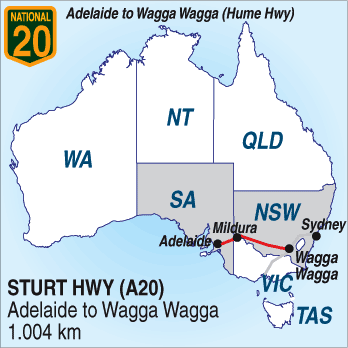
ADELAIDE TO SYDNEY: 1445km.
(1005km) via the Sturt Highway A20) to Wagga Wagga
and Hume Highway (A31) - then to Sydney. (440km.)
Joins Hume Highway (31) 55km east of Wagga Wagga.
Size is 12Mb.
|
|
AUSTRALIA STRIP MAP SERIES ADELAIDE TO SYDNEY: 1445km. (1005km) via the Sturt Highway A20) to Wagga Wagga and Hume Highway (A31) - then to Sydney. (440km.) Joins Hume Highway (31) 55km east of Wagga Wagga. |
Download a 21 page book of this highway.
Click image for a thumbnail preview. Size is 12Mb. |
|---|---|---|
|
| ||
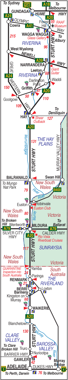 |
ADELAIDE TO SYDNEY: Via The Sturt Highway The road between Adelaide and Sydney travels for much of the way along the banks of the Murray and Murrumbidgee rivers and consequently, passes through many riverside towns developed when paddlesteamer trade along the river was the only way of marketing the bounties of the riverland soils. The road passes through the Barossa Valley, the Riverland, Sunraysia, the Hay Plains, and the Riverina regions. From the junction of the Hume Highway it leads north through Gundagai and Yass where the turn off to Canberra is, then through Goulburn and the Southern Highlands and on to Sydney. The following summary of the road includes general information and links to some of the towns and attractions along the way. Click on a town name for more details on the town. BAROSSA VALLEY:  The Barossa Valley is Australia's best known wine producing area and lies just south of the highway which goes right past the door of Mildara Blass at Nuriootpa. BLANCHETOWN: Small river town with a bridge, a hotel and 24 hour petrol and diner. Caravan Park. WAIKERIE: Waikerie is the first of the Riverland towns you will encounter and is surrounded by thousands of citrus trees. BARMERA: Barmera is just across the Kingston Bridge and is a popular golf and holiday spot. BERRI: Berri is the unofficial capital of the Riverland and is a wine and fruit growing area with a ferry across the river to Loxton. RENMARK: Renmark and Paringa are twin towns on the Murray and the last South Australian towns before heading into Victoria PARINGA: MILDURA: 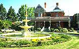 Mildura is the capital of the fertile Sunraysia area, one of Australia's largest producers of citrus, grapes and stone fruits. It is on the border of Victoria and New South Wales. EUSTON: ROBINVALE: BALRANALD: HAY: Hay is at the centre of the Hay Plains and at the junction of two highways to Sydney. It is a major stop for travellers along both roads with plenty of accommodation and lots to see and do. GRIFFITH:  NARRANDERA: At the junction of the Newell and Sturt Highways on the Murrumbidgee River. 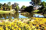 WAGGA WAGGA: Wagga Wagga is New South Wales largest inland city. It is 55km from the Junction with the Hume Highway from Melbourne to Sydney. WAGGA WAGGA TO SYDNEY From Wagga Wagga, the road joins the Hume Highway and travels through Gundagai and Yass to the turn off to Canberra and the A.C.T. The direct route by-passes Canberra and continues through the large town of Goulburn and the Southern Highlands to Campbelltown and on to Sydney. GUNDAGAI: YASS: A large commercial and rural centre on the Murrumbidgee River. GOULBURN: A large town with many historic buildings located at the southern edge of the Southern Highlands. SOUTHERN HIGHLANDS: CAMDEN: CAMPBELLTOWN: Historic town in Macarthur Country and among the first settlements of Australia. SYDNEY: 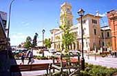
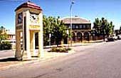 Main street of Goulburn and Historic Moss Vale buildings. |
Some shit |
 © Copyright Peter W. Wilkins
 | |