 AUSTRALIA STRIP MAP SERIES
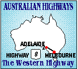
ADELAIDE TO MELBOURNE: The Western & Dukes Highway (8)
 |
 AUSTRALIA STRIP MAP SERIES
ADELAIDE TO MELBOURNE: The Western & Dukes Highway (8) |
|---|---|
|
| |
 |
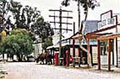
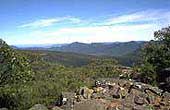
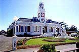
ADELAIDE TO MELBOURNE The inland highway between Adelaide and Melbourne is full of things to see and do. It passes through rich pastoral country, beside national parks including one of Australia's finest, The Grampians, and through the historic towns of Ballarat, Ararat and Stawell, all founded in the 1850's when more gold was found in this country than anywhere else. Wilkins Tourist Maps publish free maps of major centres between Adelaide and Melbourne which are available locally from all information centres except Ballarat which seems to have a new manager every year and has refused to have our free maps in their centre despite repeated requests from us and local operators. Wilkins Tourist Maps will be opening our own Information Centre in Ballarat in January of 2007 to remedy this and you will be able to book accommodation and tours, view videos, get maps of all Australia, and enjoy a snack and coffee on the premises. You can pick up our Ballarat map from Information Centres in Ararat, Stawell, Horsham, Kaniva, Bordertown, Keith, Tailem Bend or Murray Bridge or from accommodation places in Ballarat. The following summary of the road includes general information and links to these towns and attractions. MURRAY BRIDGE: Murray Bridge was settled around a ford across the River Murray and is a busy commercial centre servicing the area east of Adelaide. Besides river activities it has a Butterfly House, childrens Puzzle Park, and a scrumptious chocolate factory. TAILEM BEND: Tailem Bend is a rail and road junction on the highways from Melbourne and Sydney. It takes its name from the sweeping bend of the River Murray. The interesting pioneer village of Old Tailem Town is 2km. west.  A street in old Tailem Town KEITH: Keith is at the junction of the alternative route to Mount Gambier via Naracoorte and Penola BORDERTOWN: As its name suggests, Bordertown is near the South Australian/Victorian border. It is the administrative centre for the Tatiara Region. KANIVA: Kaniva is a rail and wheat centre and the first major town into Victoria from South Australia. NHILL: Nhill is the touring centre for the Little Desert National Park and a small town servicing a large agricultural centre. HORSHAM: Horsham is the Capital of the Wimmera Region and is the western gateway to The Grampians National Park. Located on the Wimmera River it offers plenty to see and do and has ample and varied accommodation GRAMPIANS NATIONAL PARK: The Grampians are one of Victoria's finest national Parks and are just south of the Western Highway between Horsham and Stawell. You must visit, they are magnificent.  View from Mt William STAWELL: Stawell is a goldmining town and main touring centre for The Grampians. The World in Miniature is well worth a visit and there are many motels along the highway. GREAT WESTERN: Pretty highway town and the source of Great Western Champagne. Several wineries in the area including Bests's, at the western end of the town. ARARAT: Ararat is a town at the eastern end of The Grampians and has several wineries  Town Hall in Ararat BALLARAT: Ballarat is the most significant city along the highway and is steeped in political and goldmining history. It is well worth putting a couple of days aside to explore this attractive and beautiful city. |
 © Copyright Peter W. Wilkins
 | |