|
Wilkins Tourist Maps produces two free map in this area. You can pick up an East Coast South or East Coast North map from accommodation houses, attractions and businesses, and some information centres in towns in this area. Select an area from below to automatically open it on this page.
|


|
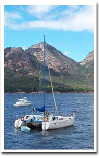
THE EAST COAST SOUTH SORELL TO BICHENO We have split the east coast tour into two sections to cover each in better detail. This map covers the highway from Sorell in the south to Bicheno and includes Triabunna, Orford, Maria Island, Swansea and the Freycinet Peninsula. The northern section is from Bicheno to St Helens and includes Fingal, Avoca and St Marys along the Esk Main Road. The East Coast of Tasmania is its holiday playground. Golden beaches, national parks, quaint fishing villages, coastal scenery, convict history and a wide variety of accommodation and attractions make it a popular destination all year round. The road which passes through this area follows the coast most of the way from Sorell to St Helens with a
minor detour to explore the wonderful Freycinet Peninsula and the pretty town of St Marys in the north. |
FLASH FILE:
Hold down ALT (PC) or CONTROL (Mac) and click on image to zoom.
Drag to navigate.
CLICK ON A TOWN FOR MORE
EAST COAST SOUTH
East Coast South Main Towns:
Bicheno
Buckland
Orford
Coles Bay
Triabunna
Swansea
EAST COAST SOUTH
Douglas Apsley National Park
Freycinet Peninsula
Friendly Beaches
Maria Island
Morris Store
Schouten House
Shipwreck Monument Swansea
Swansea Bark Mill