 |
Rosebud Victoria 3939 |
|
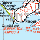
Population: 13500, Elevation: 5, Latitude: 38.22.00 Longitude: 144.53.00 Location: 75km south of Melbourne Highway: Nepean Hwy then Point Nepean Rd. Nearest Major Town: Mornington Nearest Airport: Melbourne Touring Area: Bays & Peninsulas | |
| Seaside town in the southern corner of the Peninsula. Named after the schooner Rosebud¿ which ran aground near the spot in 1851. Beaches, fishing, scenic drives, bushwalking. | |
 |
 Main street of Rosebud |


© Copyright Peter W. Wilkins