 |
Laverton WA 6440 |
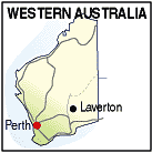
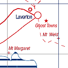
| Population: 300, Height above sea level: 461m Latitude: -28.63800, Longitude: 122.40400 Location: 955km north east of Perth Highway: Off Goldfields Hwy at Leonora. Great Central Rd from the east. Nearest Major Town: Kalgoorlie Nearest Airport: Kalgoorlie Touring Area: Goldfields - Esperance | |
|
Important staging point for the trip across the Great Central Road to
Ayers Rock and Alice Springs. Gold was discovered in the area in 1896 and many
prospectors and miners moved into the area including Dr Charles W. Laver,
who became an enthusiastic supporter and promoter of the region, and after whom the
town was named. It was gazetted in 1900. In 1969 prospector Ken Shirley found large deposits of nickel which began the 'Poseidon' share bubble of the 1970s which led to massive share trading. It was developed into the Windarra Nickel Project which traded for over 20 years. There is an airstrip and some accommodation. Contact the visitor centre for information. | |
 |
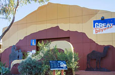 Laverton ;Beyond; Visitor Centre |


© Copyright Peter W. Wilkins