 |
Merredin WA 6415 |
| Population: 2,900, Height above sea level: 320m Latitude: -31.30002, Longitude: 118.42100 Location: 260km east of Perth Highway: Great Eastern Hwy Nearest Major Town: Perth Nearest Airport: Perth Touring Area: WA Wheatbelt | |
|
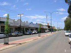
Like many towns along the Great Eastern Hwy, Merredin began as a resting place
for hopefuls on their way to and from the gold diggings around Coolgardie
and Kalgoorlie. The area was first explored by Surveyor-General J. S. Roe in 1836 on his expedition but it was not until the 1890s its potential for grazing was recognised and some settlement occured. A series of wells was established to provide water to the harsh environment and pastoral leases were taken up. Although there was no town until 1893 when the railway reached Merredin, prospectors used it as a stop-over. A water catchment area around Merredin Peak guaranteed a permanent and adequate supply of water and the towns future was ensured. In 1904 an Agricultural Research Station was built and land was offered for sale to the public. The area now produces some 40% of Western Australia's wheat quota which is mainly processed at the local bulk handling facility and sent by rail to ports. There is a railway museum, a military museum and the historic Cummins Theatre to visit. There is plenty of accommodation including motels and caravan parks. | |
 |
 |


© Copyright Peter W. Wilkins