 |
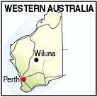
Wiluna WA 6646 |
| Population: 680, Height above sea level: 520m Latitude: -26.3542, Longitude: 120.1400 Location: 950km north east of Perth Highway: Gunbarrel Hwy (east) and Meekatharra - Wiluna Rd (west) Nearest Major Town: Meekatharra Nearest Airport: Wiluna Touring Area: WA - Mid West | |
|
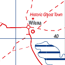
Remote outback town at the western end of the Gunbarrel Hwy connecting with Ayers
Rock in the Northern Territory. Also the southern end of the Canning Stock Route> The town has a general store, petrol, caravan park, sports oval, school, health clinic, shelter and more. It is predominately aboriginal with 'fly-in, fly-out' personell serving the mining activities. Roads are unsealed and affected after rains. The area was explored by Lawrence Wells in 1892 and gold was found in 1896, quickly attracting some 300 prospectors in the area. Wiluna was gazetted as a town in 1898 adapting the aboriginal name for the area. By the 1930s it had a population of over 9,000 people, but World War II severely affected the gold mining industry, and many mines were shut down. By 1963 the population had fallen to less than 100 until gold mining resumed in 1981. A former Governor-General of Australia, Major General Michael Jeffery was born in Wiluna on 12 December 1937. | |
 |
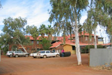 Hotel Motel at Wiluna |


© Copyright Peter W. Wilkins