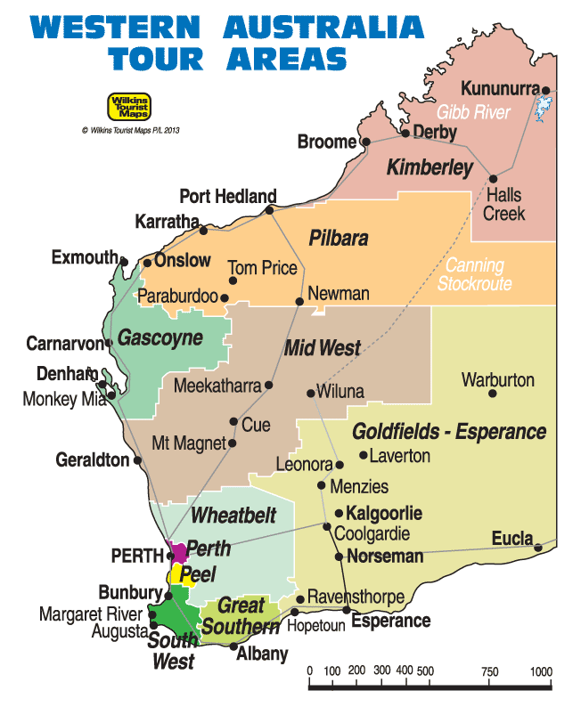
The Perth Mint


|
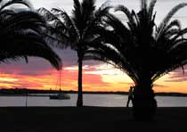
PERTH AND SURROUNDS
Perth is the capital of Western Australia and the most remote capital city in the world. It is the touring
and commercial centre for the state and a spectacular place to visit and explore.
To the south is the
winery and forest region, to the north the Coral Coast and to the east, rich grain and wine producing areas.
|
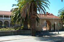
Cable Beach near Broome
|
THE PILBARA
Western Australia's Pilbara region covers an area of some 400,000 sq km
including some of the world's most ancient natural landscapes. Renowned for its
massive mineral wealth it is also an exciting touring area containing the Karinji,
Millstream Chichester and Rudall River National Parks. Waterfalls, swimming holes,
stark ranges, aboriginal art and culture, and open desert country describe the inland
while the coastal region has fabulous beaches, islands, archipelagos and teeming sealife.
|
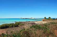
The incredible Bungle Bungles
|
THE KIMBERLEY
The Kimberley region is the north east of the state including the massive Ord River agricultural scheme
based around Kununurra and Lake Argyle. Features include the Bungle Bungles, Gibb River, the pearling town of Broome
with its fabulous beaches and coastal towns of Wyndham and Derby.
Located in the tropical zone the Kimberley has two distinct seasons - the dry and the wet. The dry, (May to Oct.),
is warm and comfortable. The wet, (Nov. to April), brings heavy showers in the evening or late
afternoon, relieving the heat of the day.
|
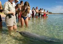 Feeding dolphins at Monkey Mia
|
THE CORAL COAST
The Coral Coast follows some 1,100 kilometres of coastline between Cervantes and Exmouth, along the coast north of Perth and
includes many of WA's favourite attractions, best beaches and family holiday destinations.
Along the way you will find the Pinnacles and Abrolhos Islands. the Kalbarri National Park, Shark Bay World Heritage Area
including Monkey Mia and its dolphins, and the marine playground known as Ningaloo Reef with its Whale Sharks. |
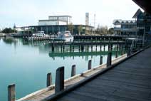 Waterfront at Mandurah in Peel Area
|
THE PEEL REGION
The Peel Region is in the south west centred around Western Australia's second largest city of Mandurah.
|
 Bunbury is at the top of the region.
|
SOUTH WEST & MARGARET RIVER
Recognised for its wine, natural charm and beauty, the Margaret River region also has an international reputation as one of the
best big-wave surfing locations for consistently spectacular breaks, with over 40 top spots along its coast, where
conditions range from powerful reef breaks to fun beach surf.
Inland are some of the world's tallest hardwood trees and ancient limestone caves open to the public.
Rock climbing, abseiling, mountain biking, canoeing and whale watching are all popular pastimes in this popular
region around 3 hours south of Perth.
|
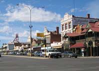
Main street in Kalgoorlie
|
GOLDFIELDS - ESPERANCE
The Goldfield region of Western Australia is in the east of the state centred around Kalgoorlie/Boulder.
Steeped in history and legend, the Goldfields is dotted with historic settlements, ghost
towns and stories of fortunes made and lost. Visit old mine shafts or the Super Pit, Australia's largest
open cut mine covering some 8 sq. km. A full day drive or a comfortable six hour train ride from Perth, it is a
living museum for the still flourishing mining industry. |
Sunset at Carnarvon in the Gascoyne area
|
THE GASCOYNE
The Gascoyne is an area north of Perth which is at the head of the mighty Gascoyne River and includes some of
the regions of the Coral Coast including Ningaloo Reef, Exmouth and Monkey Mia. |
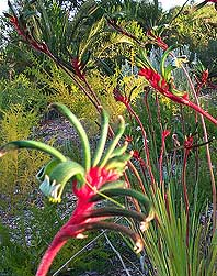
Kangaroo Paw (WA State Flower) in the Gascoyne area
|
THE WHEATBELT
The Wheatbelt is the area fertile agricultural region surrounding Perth and the hub of
a large cereal, fruit and wine producing region. |
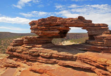
In the Kalbarri National Park
|
THE MID WEST
The Mid West is an area north of Perth which is at the head of the mighty Gascoyne River and includes some of
the regions of the Coral Coast including Ningaloo Reef, Exmouth and Monkey Mia. |
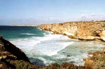
Spectacular southern coastline
|
GREAT SOUTHERN
The Great Southern Region of Western Australia includes the city of Albany, Ravensthorpe, Denmark, Walpole, Mt Barker
and many other small towns located throughout one of the most outstanding areas of natural beauty to be
found anywhere in the world.
|