The Grampians National Park is one of Victoria's most popular
holiday destinations. Only 3 hours west of Melbourne along the
Western Highway, it offers peace and tranquility, magnificent
scenery, climbs and walks, easy access to spectacular lookouts
and features, and a romantic atmosphere unrivalled elsewhere in
the state.
Kookaburras and Corellas greet you each morning as their musical
calls echo from the mountains, koalas feed in the trees and kangaroos
cross the roads at will, all creating a rustic and rural atmosphere
into which you are quickly absorbed.
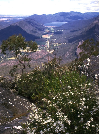
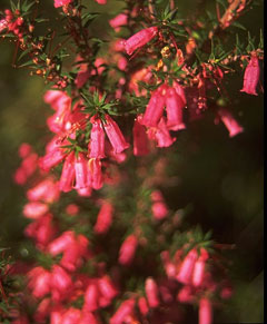
The walks and mountain-sides of the Grampians are covered with
beautiful wildflowers of every variety. The common heath (Victoria's state flower) will be
seen everywhere and in September the hills are ablaze with colour.
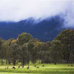
Kangaroos in the Wartook Valley
The Grampians National Park (Gariwerd) is the largest in Victoria, being approximately 100km. long and 50km. wide. Situated in the
heart of western Victoria, it is easily reached from Adelaide, Melbourne, the Riverland, the South Coast or the South East of
South Australia.
Halls Gap, Stawell and Ararat offer a broad range of accommodation and facilities for visitors, from where you can
explore the wonders of this beautiful area. Formed over hundreds of millions of years, The Grampians are a range of spectacular
sand-stone ridges, heavily timbered, and rich in wildflowers and fauna. Unusual rock formations, aboriginal rock paintings, waterfalls
and lakes, streams, and some 400km. of walking tracks make it an ideal place to spend a few days away from the hustle and bustle,
and to mingle with nature. Ongoing erosion has created unique rock formations, most of which are easily reached by car or foot,
and include the Elephant's Hide, Fallen Giant, Grand Canyon, Nerve Test, Lady's Hat and The Balconies. Walking tracks lead to such
spectacular lookouts as The Pinnacle, Mackeys Peak and Boronia Peak. By car you can reach Boroka and Reid's Lookouts, and Mount
William, all offering wonderful views across the ranges or township.
The Grampians were named when Major Thomas Mitchell visited the area and climbed Mount William in 1836. He found mountains covered
in wildflowers of all colours. Some plant will be flowering at any time of the year, however, they are best seen from August
to November. A wildflower exhibition is held in Halls Gap each September. The Grampians are also a sanctuary for the many species
of wildlife, including the common kangaroos and koalas. Other rarer species include gliders, bandicoots, potoroos and native
mice, with more than 200 species of birds in the area. Aboriginal art sites also dot the area, with more than 40 recorded, many
easily accessible.
Among the many sites in the Victoria Range are the 'Cave of Hands', 'Camp of the Emu Foot', 'Cave of Fishes',
'Fertility Cave', and 'Glenisla Shelter'. In the Northern Grampians, visit the Flat Rock Shelter and 'Cave of Ghosts'. Nearer Stawell
you will find 'Bunjil's Shelter'. Information Centres in Stawell, Halls Gap and Ararat offer detailed brochures and information
on the park.
LEFT: View over Halls Gap from the Boroka Lookout and RIGHT: Brambuk Aboriginal Cultural Centre in Halls Gap.
Lookouts
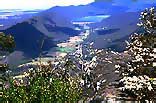
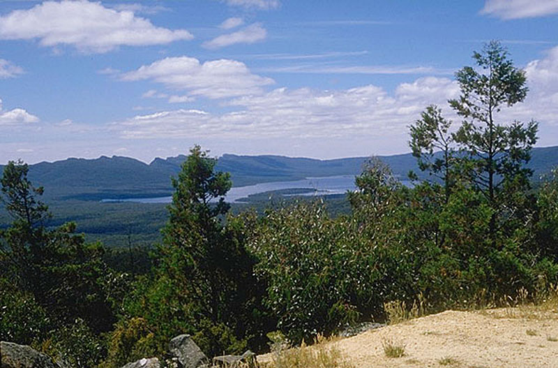
One of The Grampians best panoramas can be viewed from the Boroka Lookout, some 15km. from Halls Gap towards
Zumsteins. The view along the Fyans Valley, across Halls Gap and Lake Bellfield, and beyond, is framed by the
Senna Range to the west and the Mount William Range to the east. In the centre, immediately west of Halls Gap,
is the Wonderland Range which contains many of the features and walks for which The Grampians are renowned.
It is also possible to reach Boroka by a walking track from the junction of the Silverband and Mt. Victory roads.
(Approximately 4 hrs. return.) Picnic facilities and toilets will be found in the car park at Boroka.
Reids Lookout, 700 m. south of the Mt. Victory Rd., and 12km. west of Halls Gap, was named after Sir George Reid,
Minister of Public Works during the construction of the Mt. Victory Rd.
Reid's lookout offers 360 degree panoramas across the Victoria Valley to the south, and Lake Wartook to the north. For
hikers, a foot track leads to The Balconies and Mt. Victory.
Waterfalls
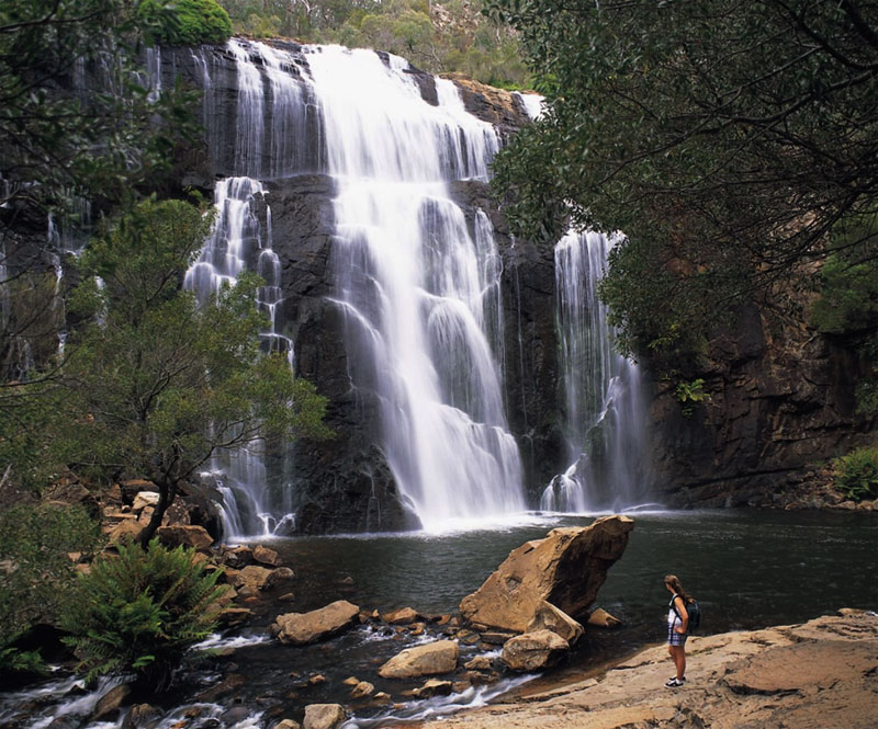
There are several waterfalls on the many watercourses in The Grampians, but by far the most popular is MacKenzie
Falls on the MacKenzie River off the Mt. Victory Rd. between Halls Gap and Zumsteins.
Named by explorer Mitchell on the 21st. of July 1836, the MacKenzie River rises in the higher reaches of The
Grampians and flows north-westward through Zumsteins towards Mt. Zero. The falls can be reached down a well
constructed walk (about 1hr. return) from the kiosk in the carpark, just off the Lake Wartook Rd. Steep in places,
it follows the river to the base of the falls offering many opportunities for spectacular photographs.
The base of the falls can also be reached along a track beside the river from Zumsteins, and there is a lookout
point along a short track about 200m. from the MacKenzie Falls car parking area on Mt Victory Rd, just past the
Wartook turn-off
Whichever way you view them, the experience is exhilarating and will ensure some excellent photographs of your
Grampians visit.
SOME TOUR SUGGESTIONS FOR YOUR SELECTION
DAY ONE:
Three kilometres through Halls Gap village the National Park Visitors Centre awaits, where an audio-visual is shown on each
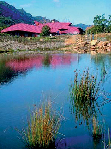
hour. The unusual, award winning architecture of Brambuk Aboriginal Cultural Centre is also worth a visit.
A stop at Silverband Falls and a 10 minute walk to see this unusual disappearing cascade is a must. Back on the Horsham Road,
turning left, follow the signs to Boroka Lookout where a splendid view of Halls Gap, the Fyans Valley, and across to The
Pyrenees and Ararat is breathtaking.
Follow the road further to Reid's Lookout and the 1km. walk to The Balconies for the adventurous. Picnic lunch at one of
these appropriate stops.
In the afternoon visit McKenzie Falls, one of the most spectacular in Victoria. There is a strenuous 40 minute walk and
steps to the foot of the falls, but an excellent alternative view can be obtained from a lookout point reached by a short
walking track from Mount Victory Road.
Stop off at Zumsteins picnic ground, where birds and kangaroos are likely to steal your food before you eat it.
On the way back to Halls Gap, stop off at the Wonderland Turntable where a few metres takes you to the bridge from where
you can view the Grand Canyon. For the agile it takes about 20 minutes to scramble to the end of the Canyon and another
hour or so to The Pinnacle, a magnificent experience which is well worth the effort in getting there.
DAY TWO:
Drive through the village and stop at Lake Bellfield. Stretch the legs with an easy walk across the top of the dam to the
spillway. A diversion to the foot of the dam is worth while when the sluice gate is open. The force of the water escaping
into Fyans Creek needs to be seen to be believed.
Continue along Dunkeld Road for about another 6 kilometres and turn left onto the Mount William Road. This road provides
some of the most attractive views to be seen in The Grampians and there are several places to stop and admire them.
From the car park it is an extremely steep 1.5km. walk up a bitumen road to the summit of Mount William. The view from
the summit is magnificent and it is a marvellous place to watch the sunrise- but the walk is not everyone's cup of tea !
A picnic lunch should be taken to any one of many suitable locations.
Back down the mountain and turn left towards Dunkeld. Another 10km. further along, turn right onto Serra Range Road. Now
you are on gravel roads leading into the Victoria Valley. In the season, many wildflowers will be found by the roadside.
The trip up the Victoria Valley gives magnificent views of the Wonderland Range as you climb up the winding road to Mount
Victory Road.
DAY THREE:
Explore the local walks; an easy, graded track to Clematis Falls (1km.), a harder climb to Chataqua Peak
(look out for koalas, kangaroos and goats), down through Bullace's Glen and back to Halls Gap. (round journey 2 to 3 hrs.)
. ....or an easy kilometre to Venus Baths...or cross the road and take the pretty track as far as you like along Fyan's
Creek.
DAY FOUR:
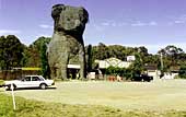
The Wildlife Park, 3km. from Halls Gap along the Ararat Road, is a well run park enabling visitors to walk amongst
animals and feed them. Allow at least 2 hours to explore the park, and have morning
coffee. Visit Boroka Winery, on your right just before the park.
Through to Pomonal and turn left onto the Pomonal-Stawell Road. Follow the signs to Bunjil's Cave. A short walk to see one
of Victoria’s most important aboriginal art sites. Many people are deeply moved by the atmosphere at this sacred place.
On to lunch at Stawell and visit Centennial Park where the Stawell Easter Gift, the world's oldest and richest professional
foot race, is run each Easter Monday. Visit Stawell's Mini World, then travel east to Great Western to visit the wineries
and for a tour of Seppelt's underground cellars. Return via Moyston.
DAY FIVE:
Head north from Hall's Gap and, just before the bridge, turn into Roses Gap Road. Follow this gravel road for
about 20km. stopping to look at the old quarry and miners huts. At Roses Gap you can turn left and stop at many points
for short walks to see the Beehive Falls, the wildflowers at Trooper's Creek, etc. This road eventually joins Mount Victory
Road, but check with the National Parks Centre for road conditions.
Straight on at Roses Gap takes you to Mount Stapylton, Mount Zero and Hollow Mountain. Magnificent walks and views
for the energetic. Continue on to visit the Olive Plantation at Laharum , then back via the Mount
Victory Road to return to Halls Gap.
This brief overview should give you some idea of the extent of this wonderful National Park.
Stawell & Grampians Information Centre. (Open daily)
50-52 Western Highway. Stawell. 3380.
Ph: 1800 065 599
Halls Gap Information Centre.
Grampians Rd. Halls Gap.
Ph: 1800 065 599
Dunkeld Information Centre. (Southern Grampians)
Glenelg Hwy. Dunkeld.
GETTING THERE: From Melbourne and the east
By road along the Western Hwy (8) to Ararat or Stawell and turn
off From Warrnambool and the south
take the Henty (from Portland), Glenelg or Hamilton Hwys to Dunkeld
and enter the park from the south. From Adelaide and the east
Along the Dukes and Western Hwys from Adelaide to Horsham or from
Mount Gambier, to Penola and take the Wimmera Highway to Horsham.
Enter the park from the west via Wartook. Light Plane
There are small airports at Stawell and Ararat.
Coach or Rail from Melbourne and Adelaide Coach Operators
V/Line: (Adelaide - Melbourne)
McCaffertys/Greyhound: (Interstate - Adelaide)
Firefly: Stawell - Melbourne - Stawell
Great Southern Railway to Ararat or Stawell
Head Office: 132 147
TOURS: Tour Operators:
Grampians Highlights Tour - Touring Downunder.
Full day tour 9.30am to 5.00pm.
Book at reception at your accommodation.
A suggested round trip is marked in orange on the touring map. Select an area from below to automatically open it on this page.
Wilkins Tourist Maps produce a free map in this area. You can pick up a Grampians, map
from accommodation houses, attractions, businesses, and information centres in towns in this area.